One of the challenges facing transportation agencies today is how to conduct accurate, timely, and safe bridge inspections. Maintaining bridges is important to ensure public safety, and bridge owners and engineers need to perform regular inspections to determine the structural integrity of bridges so that they can plan for maintenance, rehabilitation, and replacement of those bridges.
Traditional visual inspections that take place on site are labor intensive, can require expensive equipment, often require lane closures that create inconvenience for travelers, may present safety risks, and can be inaccurate and error-prone.
National bridge inspection standards in the U.S. require additional data inputs and adds another layer of complexity. In the COVID-19 environment, maintaining social distancing and ensuring safety for employees and the public can present additional challenges.
Digital Twins—Bringing Data to Life Online
Some of Bentley System’s most innovative users are reimagining inspections through the lens of digital twins. A digital twin is a digital representation of a physical asset, process, or system, as well as the engineering information that allows us to understand and model its performance. A digital twin can combine data from continuous surveys, photogrammetry, LiDAR, and sensors, as well as track changes to assets on a timeline, enabling owners to view the digital representation of the infrastructure asset and related real-world conditions over time.
As DOTs and agencies are being pressed to show the most effective use of their limited funding, taking advantage of digital twins can provide for safer, less expensive, and more timely and accurate inspections. Digital twins allow owners to track historical changes and understand information—such as the exact size of cracking, corrosion, or section loss—rather than trying to determine this information by looking at pictures taken over time.
Minnesota DOT Takes the Lead
We have seen transportation agencies, such as Minnesota DOT, use unmanned aerial vehicles (UAVs) to assist with their inspections and achieve savings of as much as 50% with these methods. Because bridges have such a long lifecycle, often up to 75 to 100 years, it is important to track change to the structures over time. These DOTs have found that by deploying UAVs and having a digital twin, they were able to see the change over time and have a holistic view of the bridge, including seeing past inspections laid on top of the current data, which can improve efficiency and help predict the future.

A reality model of the Stone Arch Bridge in Minneapolis Minnesota using Bentley’s ContextCapture software. Image source: Bentley Systems.
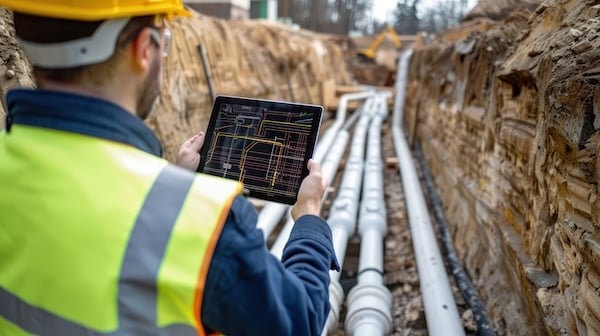
There is great opportunity for agencies to use UAVs to complement and augment standard and in-field inspections. The data from these inspections can be reviewed quickly and easily from anywhere, whether in the office or a remote location. When engineers review time-lapse comparisons of detailed changes, they can annotate specific areas of concern and designate anything that needs to be specifically reviewed in the field. Field crews can see all the inspector notes right on the structure, which is more visual, more accurate, and more efficient.
Taking advantage of digital twins allows inspectors to immerse themselves in the model of a bridge structure without being physically on site. Inspectors conduct inspections using the digital twin of the asset, along with immersive inspection capabilities with Microsoft Azure Remote Rendering and Microsoft HoloLens. Inspectors can conduct significant parts of the inspection while in the office, reducing the time required in the field, which makes the overall inspection quicker, more efficient, safer, and less costly. A digital twin provides flexibility, as you can conduct more in-depth inspections without having to schedule expensive equipment and labor for that purpose. Applying digital twins over many large, complex, or signature bridges can lead to significant savings, while increasing safety and providing richer visualization is the ultimate goal.
The state of Minnesota Department of Transportation has taken on digital twin technology and is reimagining bridge inspection with Microsoft Azure Remote Rendering and Microsoft HoloLens.

Using digital twins along with the immersive capabilities in Microsoft HoloLens2, allow inspectors to view the model of a bridge structure without being physically onsite. Image source: Bentley Systems.
Jennifer Wells, State Inspection Engineer for Minnesota DOT shares more about this project: “It is important to make sure our assets are being maintained and scoped properly for different projects. Especially in the U.S. where all of our bridges and roads were built around the same time period, and they are coming towards that same end of life span, so the importance of correct data and the condition is very important.”
“Showing the data we have collected over the past five years we see a direct correlation between using drones to create 3D models and digital twins on bridges as opposed to using our traditional access methods like snooper trucks and lifts, and we have found a 40% cost savings overall.”
3D Model Becomes Reality Mesh
One of the biggest advancements that we see is a reality mesh, the visualization for a digital twin that gives yet another dimension to our understanding of the infrastructure and surrounding topography. A reality mesh is a 3D model of real-world conditions that contains large amounts of triangles and image data. Each digital component can be automatically recognized and/or geospatially referenced, providing users with an intuitive and immersive way to navigate, find, view, and query their asset information. They can use reality meshes in many engineering, maintenance, or GIS workflows to provide precise real-world digital context for design, construction, and operations decisions. The photos, videos, and data captured by unmanned aerial vehicles (UAVs) can be used to produce a high-resolution reality mesh of a bridge. When this reality mesh is combined with other relevant data, it provides an even more realistic digital twin representation. And using reality meshes for inspections can significantly decrease the amount of time inspectors have to be on and around structures in the field.

Collins Engineers uses UAVs and reality modeling to create model of Stone Arch Bridge to document inspection results in the field. Image source: Bentley Systems.
Utilizing digital twins and technology—including UAVs—to collect, process, store, and analyze large amounts of data can reduce costs and increase quality of inspections. The immersive inspection capabilities in Microsoft HoloLens can reduce the time required in the field, while making inspections more efficient, safer, and less costly. The technology can improve safety for inspectors and the public at large and help preserve bridge infrastructure into the future.


Share This Post